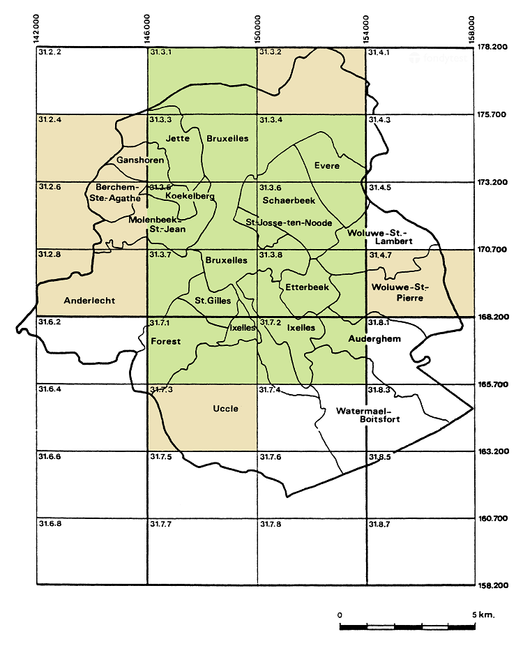
The geotechnical maps of Brussels were edited between 1976 and 1990 by the ‘Institut Géotechnique de l'État’ on a 1:5000 scale under supervision of J. Nuyens (ULB).
31.2.4 (1990)*
31.2.6 (1987)*
31.2.8 (1988)*
31.3.1 (1984)
31.3.2 (1985)*
31.3.3 (1979)
31.3.4 (1984)
31.3.5 (1977)
31.3.6 (1977)
31.3.7 (1976)
31.3.8 (1978)
31.4.7 (1992)*
31.7.1 (1982)
31.7.2 (1983)
31.7.3 (1986)*
All the maps are available in a digital format on the bruxellesenvironnement.be website:
Available geotechnical maps of Brussels area (Lambert belge 1972 co-ordinates).
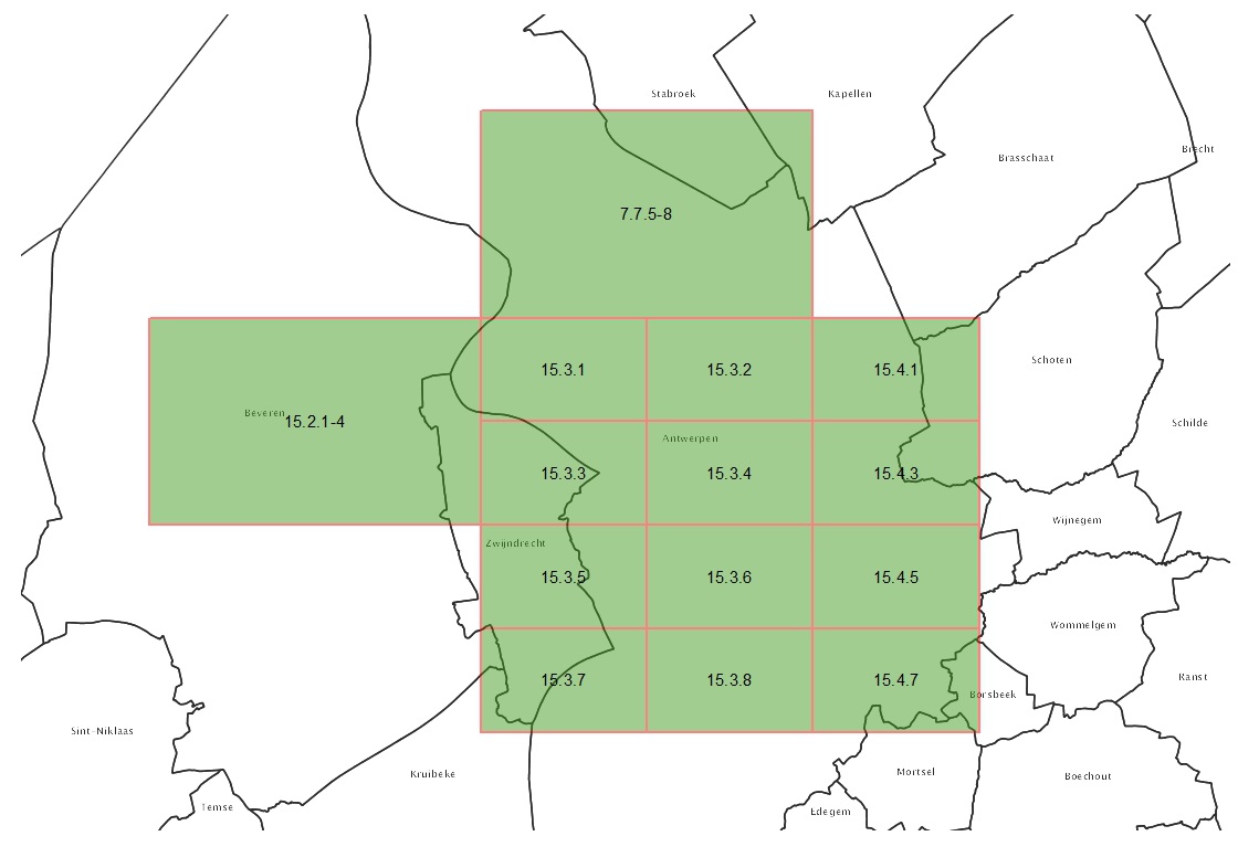
Antwerpen - Anvers
The geotechnical maps of Antwerpen and Gent were edited between 1976 and 1993 by the ‘Kommissie of Werkgroep voor Grondmechanische Kartering’ and the ‘Centrum voor Grondmechanische Kartering van de Rijksuniversiteit Gent’ on a 1:5000 scale by I. Bolle, M. Buysse, E. De Beer, W. De Breuck, M. DeCeukelaire, G. De Moor, D. Desmet, J. D'Huyvetter, G. Franceschi, J. Maertens, M. Mahauden, I.Meyus, R. Tavernier, Ph. Van Burm, and W. Van Impe.
Available geotechnical maps of Antwerpen (Anvers) area (source).
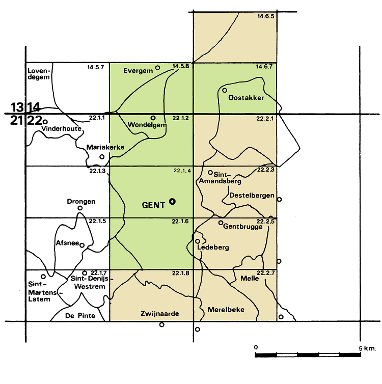
Gent - Gand
The geotechnical maps of Antwerpen and Gent were edited between 1976 and 1993 by the ‘Kommissie of Werkgroep voor Grondmechanische Kartering’ and the ‘Centrum voor Grondmechanische Kartering van de Rijksuniversiteit Gent’ on a 1:5000 scale by I. Bolle, M. Buysse, E. De Beer, W. De Breuck, M. DeCeukelaire, G. De Moor, D. Desmet, J. D'Huyvetter, G. Franceschi, J. Maertens, M. Mahauden, I.Meyus, R. Tavernier, Ph. Van Burm, and W. Van Impe.